GHMC Appealed To People To Cooperate For A Level Survey As Part Of GIS Mapping

Hyderabad, July 30 (Maxim News): As part of the GIS mapping survey of assets and utilities under GHMC, field level survey has started from today. Integrated GIS survey as part of urban planning has started from Tuesday. In this background, the details of all the properties and utilities in Hyderabad can be identified geographically due to accurate mapping. Tax collection will also be easier.
Click Here To Join Us On WhatsApp
It can be said that it will help in solving problems related to property tax and online payments will become easier. High-resolution mapping makes the details of roads, parks, and other facilities clear.The field level survey has started today (Tuesday) in many circles, this field survey is being conducted in Uppal, Hayat Nagar, Hyder Nagar, Kukat Pally, KPHB Colony, Miyapur, and Chandanagar areas. The survey will continue in all other parts of the city.
House owners have been asked to cooperate in this survey undertaken by GHMC for resource management. GHMC asked the survey staff to provide the information requested. The details of the survey will be kept strictly confidential.GHMC has requested the staff to come for a field survey to provide a building permit, occupancy certificate, latest paid property tax receipt, nalla bill, electricity bill, owner ID details, trade license number (for commercial buildings), and cooperate. Door-to-door physical surveys of building structures will be checked again as per the drone survey. (Maxim News)
Next Story :
-
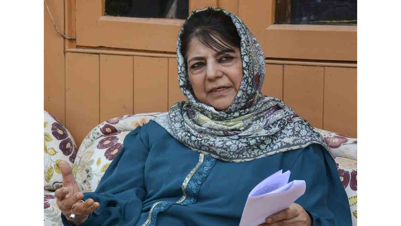
Mehbooba Mufti Seeks Dignified Return Of Kashmiri Pandits
![Mehbooba Mufti Seeks Dignified Return Of Kashmiri Pandits]()
PDP President Mehbooba Mufti on Monday sought dignified return and rehabilitation of kashmiri Pandits, saying their reintegration must not be viewed merely as a symbolic return, but as an opportunity to build a shared, inclusive and forward-looking future for Jammu and Kashmir.
Now you can get the latest stories from Indtoday on Telegram every day. Click the link to subscribe. Click to follow Indtoday’s Facebook page, Twitter and Instagram. For all the latest Hyderabad News update
-
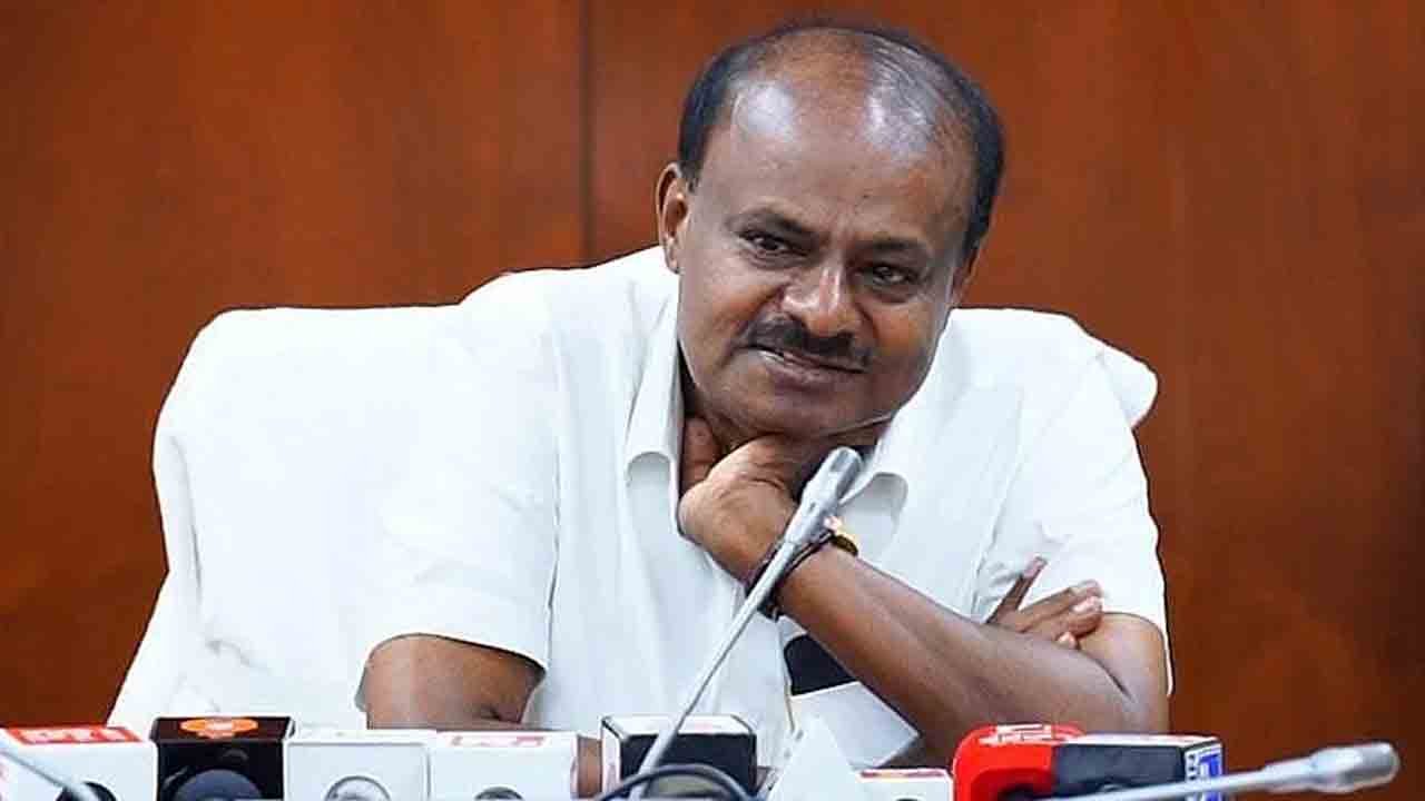
Hyundai, KIA, Mercedes Benz, Volkswagen, Skoda Interested In Making EVs In India: Minister
![Hyundai, KIA, Mercedes Benz, Volkswagen, Skoda Interested In Making EVs In India: Minister]()
Global automobile makers, including Mercedes Benz, Skoda-Volkswagen, Hyundai, and Kia have shown interest in manufacturing electric cars in India. Union Heavy Industries Minister H.D Kumaraswamy said on Monday.
Now you can get the latest stories from Indtoday on Telegram every day. Click the link to subscribe. Click to follow Indtoday’s Facebook page, Twitter and Instagram. For all the latest Hyderabad News update
-
Hyderabad Police Warn Raja Singh Over Disregarding Security Arrangements
![Hyderabad Police Warn Raja Singh Over Disregarding Security Arrangements]()
The Hyderabad Police have yet again issued a formal notice to BJP MLa T.Raja Singh, warning him against disregarding government – assigned security arrangements including a bullet proof car and gunmen, especially while visiting highly sensitive areas.
Now you can get the latest stories from Indtoday on Telegram every day. Click the link to subscribe. Click to follow Indtoday’s Facebook page, Twitter and Instagram. For all the latest Hyderabad News update
-
KCR To Appear Before Kaleshwaram Commission On June 11
![KCR To Appear Before Kaleshwaram Commission On June 11]()
BRS President and former chief minister K.Chandrasekhar Rao is ready to appear before the Kaleshwaram Commission for questioning. It is known that the Commission has sent notices to appear on June 5.
Now you can get the latest stories from Indtoday on Telegram every day. Click the link to subscribe. Click to follow Indtoday’s Facebook page, Twitter and Instagram. For all the latest Hyderabad News update