GIS Survey to Enhance Urban Planning and Resource Management: Amrapali Kata
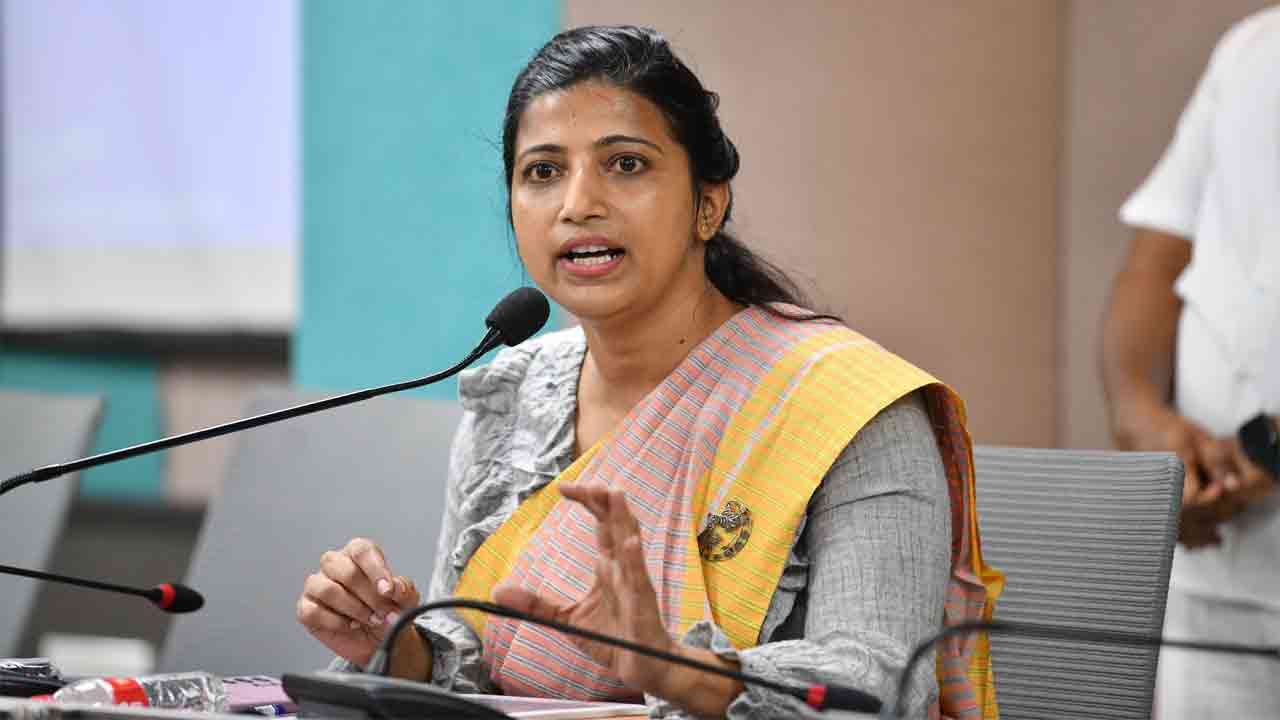
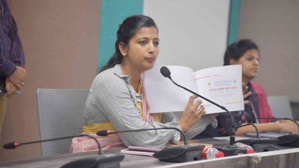
Hyderabad, Aug 8 (Maxim News): Greater Hyderabad Municipal Corporation (GHMC) Commissioner Amrapali Kata has emphasized the importance of Geographic Information System (GIS) surveys in advancing urban planning and resource management, ultimately aiming to provide better services to the residents of Hyderabad.
Click Here To Join Us On WhatsApp
Comprehensive Mapping and Survey Initiatives
During a press conference held at the GHMC headquarters on Thursday, Commissioner Amrapali highlighted the ongoing efforts to transform Hyderabad into a model city for the country. As part of this initiative, an integrated GIS survey is being conducted to map all assets and utilities under the GHMC, using cutting-edge technology. The entire GHMC area is being surveyed and recorded via drones with GIS, capturing details of government lands, roads, ponds, lakes, and the city’s infrastructure.
The GIS survey is set to cover approximately 650 square kilometers of Hyderabad, including around 19.43 lakh structures, comprising both residential and commercial buildings. Of these, 2.7 lakh houses are identified as commercial properties. Once the survey is completed, each property will be assigned a digital door number.
Click Here To Join Us On WhatsApp
Digital Access to Services for Residents
A digital board will be installed in front of every house, enabling residents to access government services directly from their homes. Services such as birth and death certificates, property mutation, and others will be accessible remotely. In the event of emergencies, officials will be able to respond swiftly and provide necessary assistance.
Progress and Coverage of the GIS Survey
GIS surveys have already commenced in Hyder Nagar, Miyapur, Chandanagar, KPHB Colony, Uppal, and Hayat Nagar, covering five circles within GHMC. Drone surveys have been completed in 130 square kilometers, with 1,40,020 plots set to be digitized soon. Each property will receive a unique digital address identification number.
Public Cooperation and Reassurance
Commissioner Amrapali urged residents not to fall prey to misconceptions and to cooperate with the ongoing survey. She reassured that the survey would not lead to an increase in property taxes, as it is solely focused on mapping assets and infrastructure. The physical survey teams will collect information related to properties, utilities, and infrastructure, supported by necessary documentation.
Click Here To Join Us On WhatsApp
Infrastructure Development and Future Plans
The survey will facilitate the provision of necessary infrastructure in all colonies within GHMC, ensuring efficient urban planning. Currently, 90 teams are engaged in the survey, with a total of 600 teams expected to be deployed on the ground, completing the task within the next six months.
Commissioner Amrapali also highlighted that similar GIS surveys have been successfully conducted in various towns in Uttar Pradesh and Madhya Pradesh, and requested the cooperation of Hyderabad’s residents in this crucial initiative.
Additional Commissioner Sneha Sabarish also participated in the meeting.
More Stories :
HYDRAA Clears Encroachments In Jubilee Hills, Fences Land Worth Rs 1003 Crore
![HYDRAA Clears Encroachments In Jubilee Hills, Fences Land Worth Rs 1003 Crore]()
HYDRAA Jubilee Hills Encroachments cleared. Officials fence land worth Rs 1003 crore in Jubilee Hills and Khanamet.
Emmanuel Macron India Visit From Feb 17
![Emmanuel Macron India Visit From Feb 17]()
Emmanuel Macron India Visit begins on 17th. Talks with PM Modi, India France Year of Innovation, AI Summit and Rafale deal on agenda.
Telangana Municipal Polling Ends Peacefully
![Telangana Municipal Polling Ends Peacefully]()
Telangana Municipal Polling ends peacefully across seven corporations and 116 municipalities. Counting on 13th, mayor elections on 16th.
Online Loan Fraud: Five Arrested In Hyderabad
![Online Loan Fraud: Five Arrested In Hyderabad]()
Online Loan Fraud case in Hyderabad as Cyber Crime Police arrest five accused for duping victims through Mudra loan ads on social media.


Now you can get the latest stories from Indtoday on Telegram every day. Click the link to subscribe. Click to follow Indtoday’s Facebook page, Twitter and Instagram. For all the latest Hyderabad News update