AP to Rreceive Rain for Next 3 Days
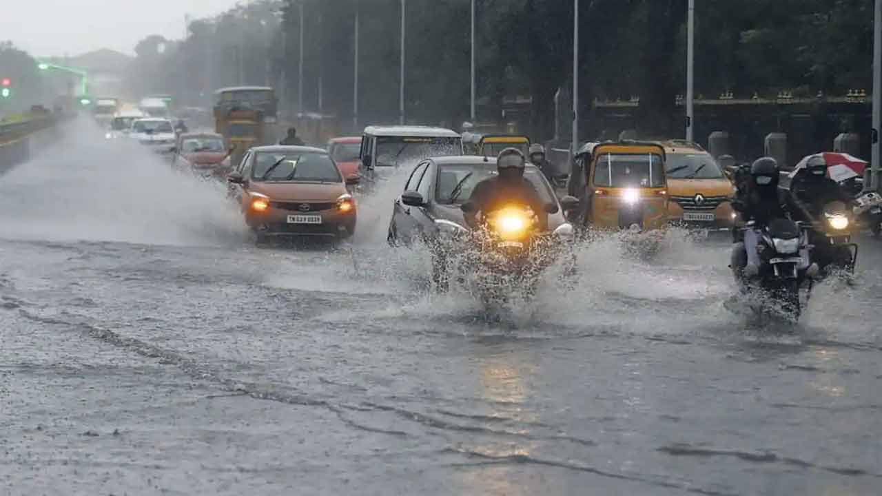
The Indian Meteorological Department has issued a weather forecast for Andhra Pradesh for the next three days. It said that the strengthened monsoon trough is now moving over Ganganagar, Rohtak, Gwalior, Sidhi, Ambikapur, Sambalpur, Balasore and southeastward to east-central Bay of Bengal. It is said that this trough extends up to 0.9 km above the mean sea level.
On the other hand, the surface trough over Jharkhand and surrounding areas is now over northern Odisha and extends up to a height of 5.8 km above mean sea level. With this, the weather department has predicted that the weather in AP will be like this for the next three days.
The Meteorological Department predicted light to moderate rain or thundershowers in North coastal Andhra Pradesh today. Along with heavy rain, thundershowers are likely to occur at one or two places.
Also, the rains are expected in south coastal Andhra today, Tomorrow, and 24th July and Light to moderate rain or thundershowers are likely at isolated places. There is a chance of heavy rains or thundershowers at one or two places.
Light to moderate rain or thundershowers are likely at isolated places in Rayalaseeema along with thunder and lightning likely at one or two places.
Next Story:
-
Gold Chain Theft Offender Arrested: Seized 45 Grams Ornaments
![Gold Chain Theft Offender Arrested: Seized 45 Grams Ornaments]()
The sleuths of crime staff of Mehdipatnam Police Station apprehended the Pocket Picker (P.P) hathagale Sanjana aged 20 years. Occ: Daily labour R/o mangar Basthi, Afzalsagar, Hyderabad on 24.05.2025 at 08.00 hrs and recovered gold ornaments wg. about 45 Grams from her possession while she was trying to sell them at Vijaynagar colony, Hyd.
-
Asaduddin Owaisi Arrives In Gulf: Operation Sindoor Reachout
![Asaduddin Owaisi Arrives In Gulf: Operation Sindoor Reachout]()
In a significant diplomatic outreach following Operation Sindoor, the central government has been reaching out to prominent countries to present India’s stance on the operation. An all -party Parliamentary delegation arrived in Bahrain on Saturday.
-
Two Mobile Phone Snatchers Arrested By Tolichowki Police
![Two Mobile Phone Snatchers Arrested By Tolichowki Police]()
Two mobile phone snatchers were arrested by the Tolichowki police on Saturday. The police seized a vehicle and recovered a mobile phone from them. The arrested are Saragandla Shiva (19) and Boddu Bhrath (19), both natives of Suryapet.
-
Govt Approves Interest Rate At 8.25 Percent On Employees’ Provident Fund For FY 25
![Govt Approves Interest Rate At 8.25 Percent On Employees’ Provident Fund For FY 25]()
Delhi/Hyderabad, May 24 (May 24): The government has ratified the rate of interest on employees’ provident fund at 8.25 per cent for FY25, enabling the retirement fund body EPFO to deposit the annual interest accumulation in the post-retirement funds of over 7 crore subscribers.
-
Shubman Gill Named India Test Captain For England Tour As Rohit, Kohli Exit Format
![Shubman Gill Named India Test Captain For England Tour As Rohit, Kohli Exit Format]()
Mumbai/Hyderabad, May 24 (Maxim News): Shubman Gill, who is having a dream run as captain of the Gujarat Titans in the ongoing IPL, has been named captain of the Indian team that will tour England next month. This was announced by the BCCI chairman of the selection panel, Ajit Agarkar, in Mumbai on Saturday.


Now you can get latest stories from Indtoday on Telegram everyday. Click the link to subscribe. Click to follow Indtoday Facebook page and Twitter and on Instagram. For all the latest Hyderabad News updates