


Hyderabad: IIIT Hyderabad announced the addition of a new program in Geospatial Technology to its transdisciplinary dual degree programs from the 2024-25 academic year. These programs combine a B.Tech (Hons) in CS and a Master of Science in domain areas by Research.
Click Here To Join Us On WhatsApp
Admissions to this CGD program will be through IIIT-H’s Undergraduate Entrance Examination (UGEE). Students who have passed the 12th class or equivalent with Maths, Physics, and Chemistry by June 2024 are eligible to apply. Those who have already registered for UGEE will have the option of including this program before finalizing their choices later.
The CGD program will equip students to become experts with the knowledge to steer the geospatial industry, address complex problems across multiple disciplines using the right set of computing and geospatial knowledge, and develop cutting-edge technologies in these areas of disciplinary overlap and intersection.
Click Here To Join Us On WhatsApp
This academic and research program is being launched to strengthen the academic and research capability in the country for Geospatial science and technology in the context of the National Geospatial Policy (NGP) 2022 which identifies the growth in this multi-disciplinary area and recognizes the need for encouraging and enhancing research and technical manpower at the university level with emphasis on emerging technologies involving the integration of Geospatial Technology with 4th Industrial Revolution Technologies.
In addition, The United Nations Integrated Geospatial Information Framework (IGIF), of which India is a key member, also identifies capacity building and Innovation in research as 2-key pillars of growth in the development and adoption of Geospatial technologies.
Click Here To Join Us On WhatsApp
IIITH’s dual degree curriculum is designed to offer a balanced and comprehensive education in Geospatial Technology and Computer Sciences. With a strategic distribution of credits across core courses, electives, and multidisciplinary subjects, students are well-prepared to tackle challenges at the forefront of technology and innovation. It emphasizes technical proficiency, encourages exploration and research, and the development of a broad skill set, aligning with the dynamic needs of industry and academia.
According to Prof K S Rajan, Registrar and Head of Lab for Spatial Informatics, “Students with a dual degree in computer science and spatial technology have a myriad of promising career prospects across academia, research, and industry. Graduates can anticipate opportunities in diverse sectors such as urban planning, environmental management, agriculture, and disaster management, reflecting the growing industry demand for their expertise. Moreover, with increasing investments in geospatial technology initiatives by the Indian government as part of its National Geospatial Policy 2022, avenues across various sectors and enterprises are going to increase”.
Click Here To Join Us On WhatsApp
Prof P J Narayanan, Director, IIIT-H said “Geospatial technologies are going to play a strong role in the coming years as data referenced to specific places is created in plenty. Services based on digital maps have transformed our lives significantly in the past decade, but what we have seen is just the beginning. I expect the graduates of this program to play lead roles in making map-based analytics and services for the use of policymakers, planners, and the common citizen in the future.”
Next Story:
Telangana High Court Adjourns MLA Defection Case To August 12

The Telangana High Court adjourned the hearing on BRS and BJP petitions seeking disqualification of defected MLAs to August 12, 2026.
Bhojshala Row: Supreme Court To Hear Plea On Alternate Namaz Site, Seeks MP’s Response
The Supreme Court will hear the Bhojshala row plea on Friday and has sought the Madhya Pradesh government’s response on an alternate namaz site.
Centre Approves Additional 8 Lakh Metric Tonnes Rice Procurement From Telangana
The Centre has approved an additional 8 lakh metric tonnes under the Telangana rice procurement target, raising the total to 43 LMT.
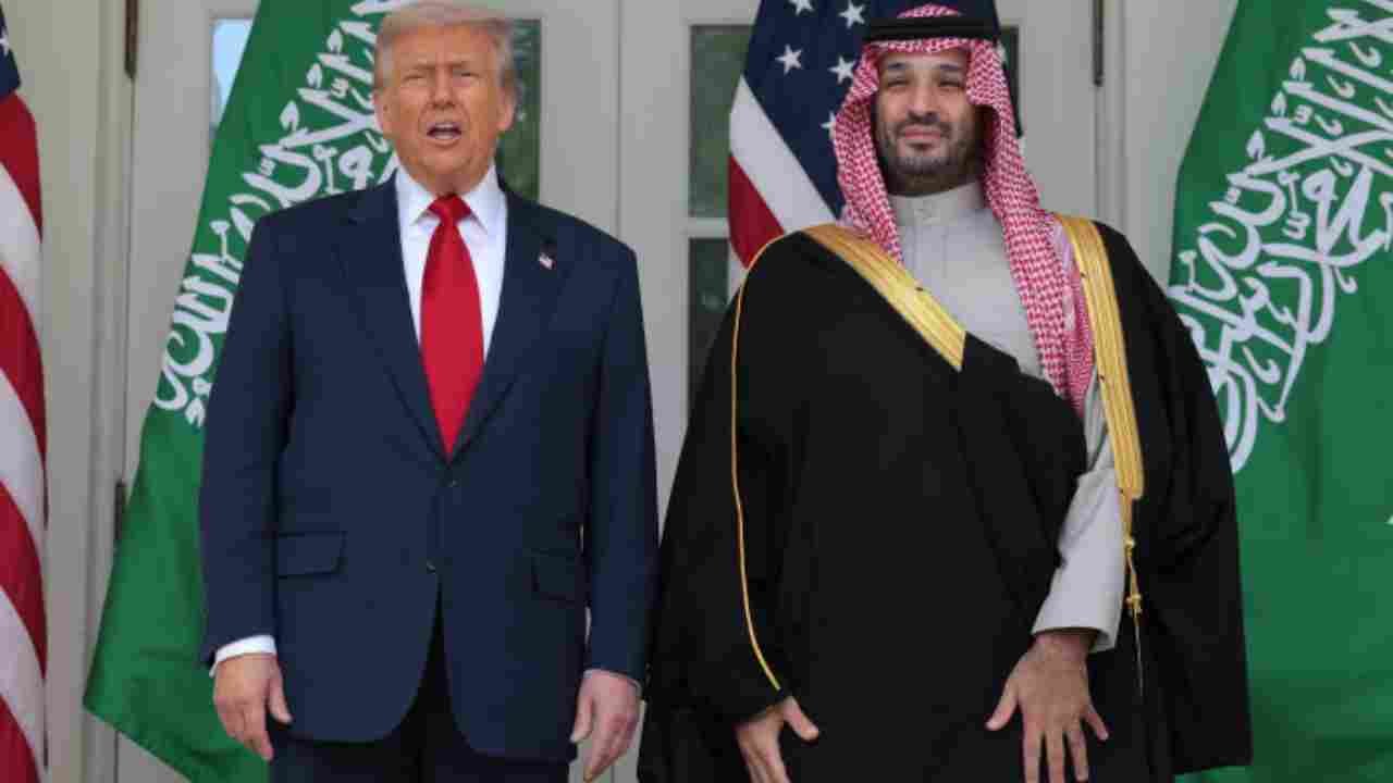
Trump Approves Civil Nuclear Agreement With Saudi Arabia
Trump approved a 30 year civil nuclear agreement with Saudi Arabia focused on uranium enrichment for peaceful energy under US supervision.
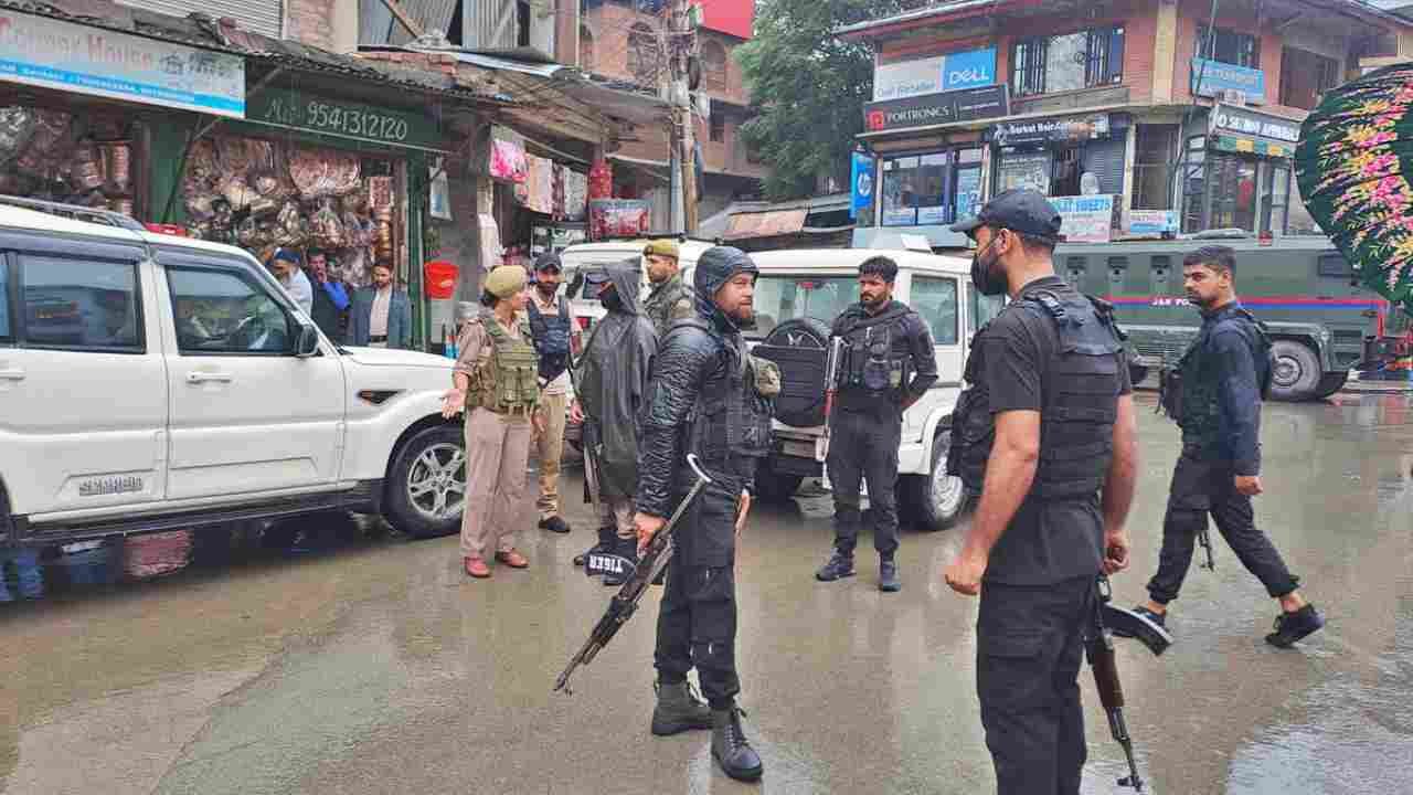
Policeman Injured In Suspected Terrorist Attack In J&K
A policeman was injured after suspected terrorists opened fire on a police party in Anantnag, Jammu and Kashmir. A search operation is underway.


Now you can get the latest stories from Indtoday on Telegram every day. Click the link to subscribe. Click to follow Indtoday’s Facebook page, Twitter and Instagram. For all the latest Hyderabad News updates